Tree Census Data
The Tree Census data takes stock of the health of trees in addition to their size. Using this data, large, unhealthy trees (>20in in diameter) are identified in the boroughs - trees that may pose safety risks for citizens. All daycare, hospitals, nursing homes, schools, and homeless facilities within 100 meters of "large unhealthy trees" are mapped to show populations especially at risk. These locations were identified with the NYC OpenData Selected Facilities and Program Sites dataset
Percent of Healthy Trees per Borough
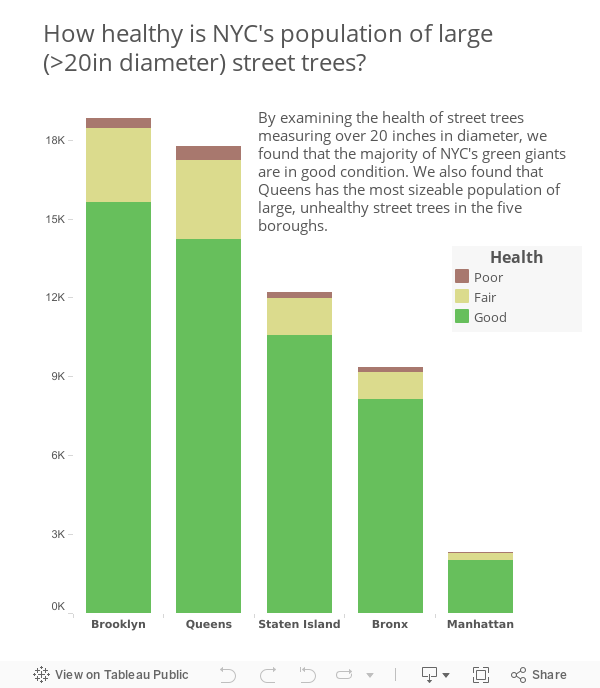
Health by Borough
This bar chart gives an overview of distributions of trees by health as recorded in the tree census. Most of the trees recorded in the census are in healthy or fair condition. However, city-wide, about 4.5% of trees (21,151) were classified as being in poor health.
311 Calls
Using the city's facilities dataset as well as the NYC OpenData's 311 Service Requests data, this map displays high-risk locations within 100 meters of trees that were reported as having broken branches, hanging limbs, dead branches and falling over.
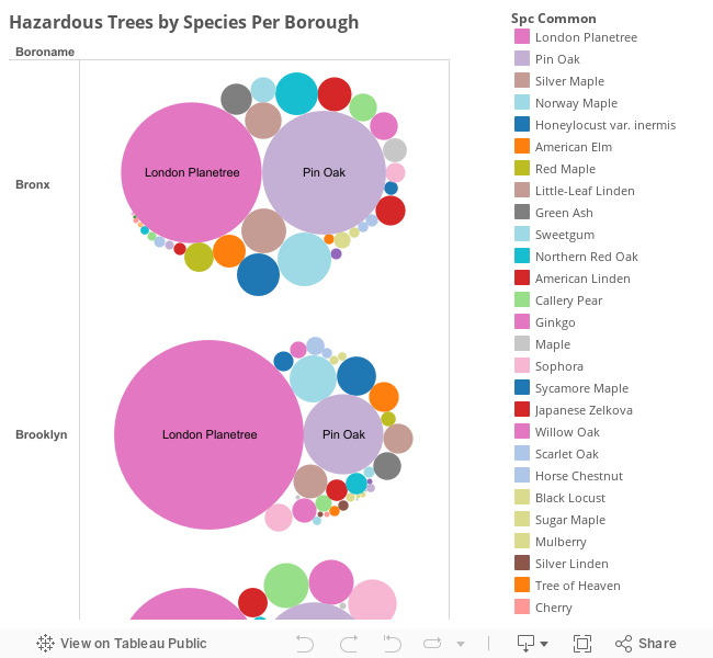
Hazardous Trees by Species per Borough
Using Tree Census Data, we were able to identify which trees species currently pose the greatest hazards in each borough. The largest orbs in this graph represent the tree species that are both large and unhealthy.